in Wickham
by Bewley Homes
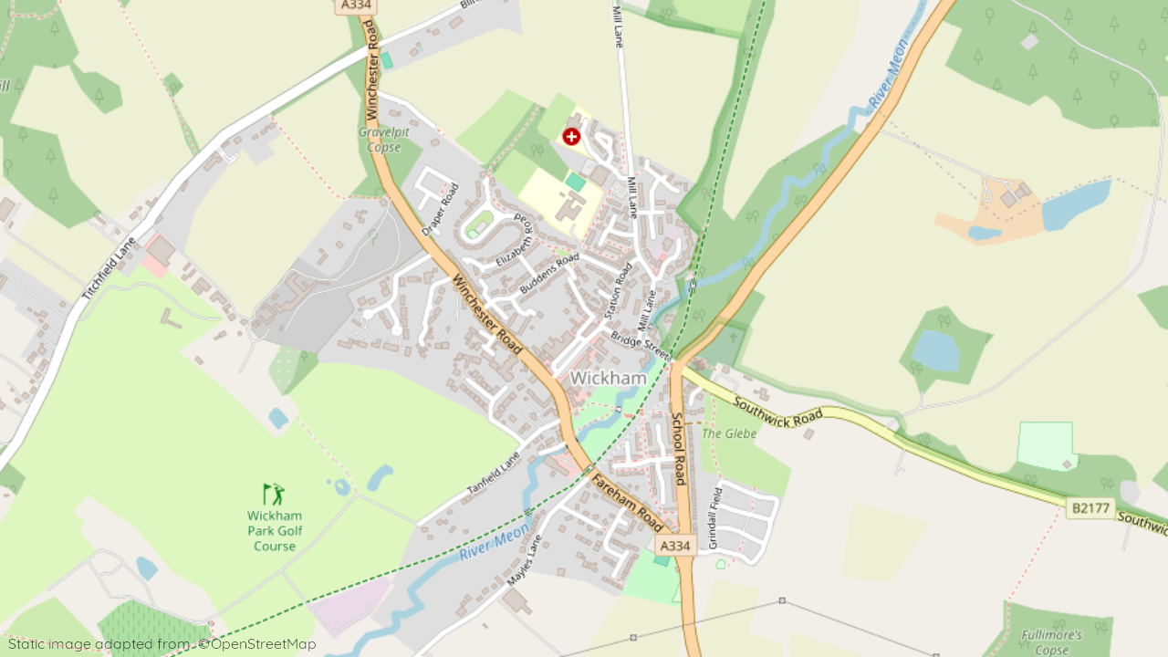
Draper Road, off Winchester Road, Fareham, Wickham, Hampshire, PO17 5QG
View on Bewley Homes website
Other showhomes in this area
More about PO17 5QG
Located on the outskirts of Wickham, PO17 5QG is primarily an industrial area with some residential streets.
Location: This postcode encompasses Draper Road, an area bordering established industrial estates and leading towards Wickham town centre.
Industry: The area features a significant presence of industrial units and warehouses, catering to various businesses and logistics.
Housing: While limited, the area offers some pockets of residential streets with semi-detached houses, suitable for individuals and families seeking affordable housing near work opportunities.
Amenities: Immediate options are limited due to the industrial focus. However, Wickham town centre offers a range of shops, supermarkets, cafes, and essential services.
Transport: Easy access to the A32 road facilitates road travel. Regular bus services connect to Wickham and surrounding areas. Fareham railway station provides connections to major cities.
Schools: Several well-regarded schools serve the wider area, including Wickham CofE Primary School and The Westgate School for secondary education.
Things to do: Explore the nearby countryside and South Downs National Park for walking, cycling, and outdoor activities. Wickham town centre offers local events and occasional markets. Portsmouth provides museums, theatres, and a wider variety of entertainment options.
In a nutshell: PO17 5QG caters to those seeking affordable housing near employment opportunities in the surrounding industrial estates. While immediate amenities are limited, Wickham town centre and nearby Fareham offer a wider range of options. The area also benefits from good transport links and proximity to the South Downs National Park.
| Category | Value |
|---|---|
| Postcode | PO17 5QG |
| Town | Havant, Rowland’s Castle |
| County | Hampshire |
| Latitude | 50.9038° N |
| Longitude | -1.1910° W |
| Altitude | 47m |
| Nearest Train Station | Botley Railway Station |
| Nearest Bus Stops | Park Place (NW), Redhill Crossroads (S), The Surgery (S), Redhill Crossroads (N), The Square (NE), The Square (NatX) (SE) |
| Administrative Areas | Wickham Parish, Southwick and Wickham Ward, Winchester Constituency |
| Distance from Sea | 4.4 miles from the Bristol Channel |
| Index of Multiple Deprivation (IMD) | 6 |
| Average Household Income | £56,000 |
| Water Company | Albion Water |