in Burscough
by Anwyl Homes
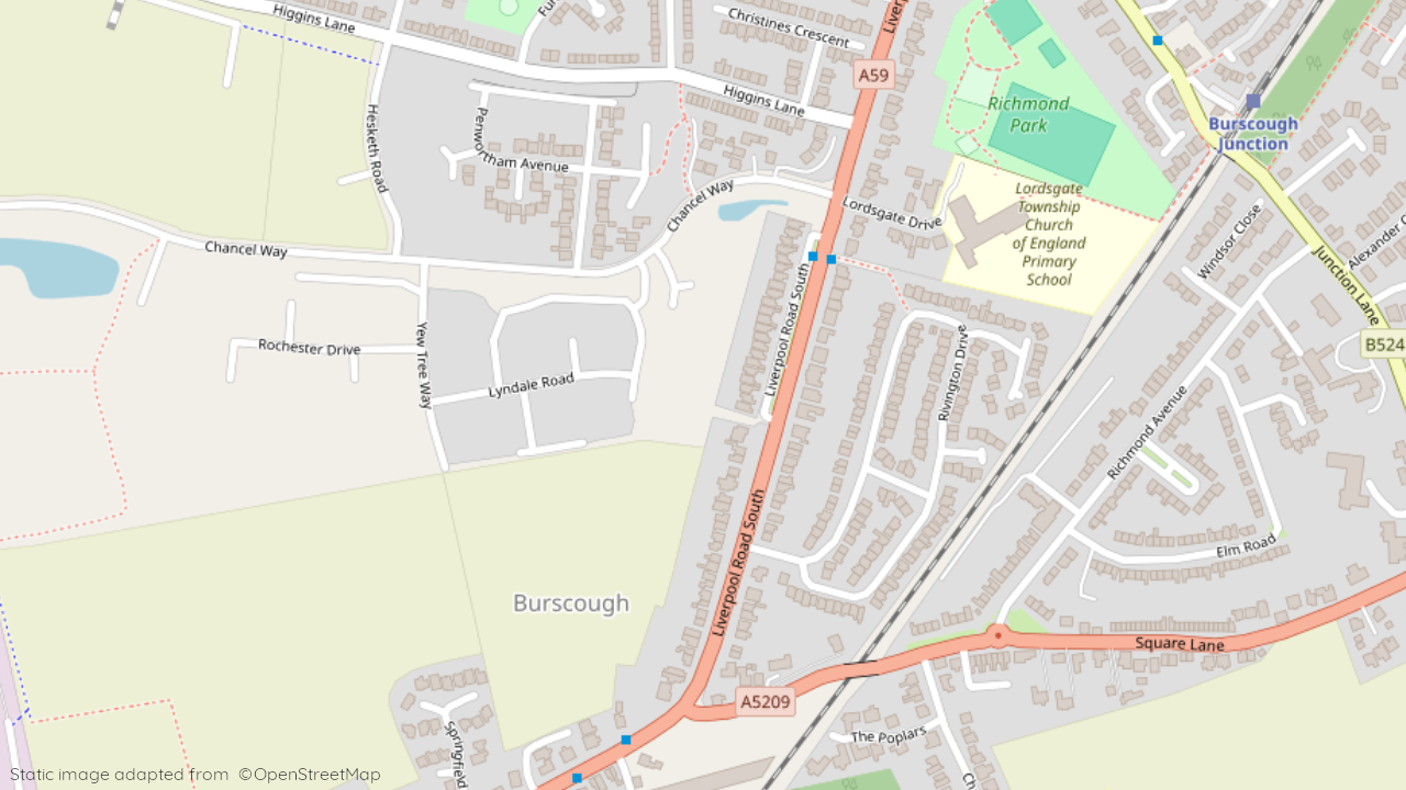
Chancel Way, Burscough, Lancashire, L40 7RE
View on Anwyl Homes website
Other showhomes in this area
More about L40 7RE
Located in the town of Burscough, L40 7RE offers a primarily residential environment.
Location: This postcode encompasses Liverpool Road South, situated within an established suburban area. The area features a mix of modern and older houses, catering to families and individuals seeking a peaceful suburban lifestyle.
Industry: Limited industrial presence in the immediate vicinity.
Housing: The area is predominantly residential, with a mix of terraced houses, semi-detached houses, and bungalows.
Amenities: Immediate options include local shops, cafes, and takeaways, with a wider range of supermarkets, restaurants, and leisure facilities available in Burscough town centre.
Transport: Regular bus services connect to Burscough and surrounding areas. Access to the M58 motorway provides connections to other major cities.
Schools: Several well-regarded schools serve the area, including Burscough Lordsgate Township Church of England Primary School and Burscough Priory Academy for secondary education.
Things to do:
Explore the nearby Martin Mere Wetland Centre, a haven for wildlife and birdwatching enthusiasts.
Visit the historic Rufford Old Hall, a Tudor manor house with extensive grounds.
Enjoy the outdoors at the Lathom Country Park, offering walking trails, a lake, and play areas.
In a nutshell: L40 7RE provides a peaceful suburban setting with good access to local amenities and the wider offerings of Burscough town centre. The mix of housing options, good transport links, and proximity to green spaces make it suitable for families and individuals seeking a comfortable lifestyle.
| Category | Value |
|---|---|
| Postcode | L40 7RE |
| Town | Burscough |
| County | Lancashire |
| Latitude | 53.5953 |
| Longitude | -2.8476 |
| Altitude | 24m |
| Nearest Train Station | Burscough Junction |
| Nearest Bus Stop | Lordsgate Drive (N) |
| Administrative Areas | West Lancashire District |
| Distance from Sea | 12.3 km |
| Index of Multiple Deprivation (IMD) | 22,047 |
| Average Household Income | £42,400 |
| Water Company | United Utilities |