in Bolton
by Bellway
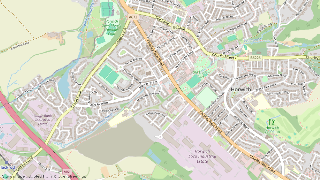
Chorley New Road, Bolton, Lancashire, BL6 5UE
View on Bellway website
Other showhomes in this area
More about BL6 5UE
Located in Horwich, BL6 5UE offers a mix of industrial activity and some residential properties.
Location: This postcode encompasses Horwich Business Park, a well-established industrial area. The area also features a small residential pocket with a mix of terraced houses and apartments.
Industry: The area is predominantly industrial, housing various businesses and manufacturing units.
Housing: Residential options are limited, with a small number of terraced houses and apartments available within the business park.
Amenities: Immediate options are limited due to the industrial focus. Residents may rely on Horwich town centre for a wider range of shops, supermarkets, cafes, restaurants, and leisure facilities.
Transport: Access to the M60 motorway is relatively easy, facilitating travel to other parts of Greater Manchester. Regular bus services connect to Horwich and Bolton.
Schools: Several well-regarded schools serve the Horwich area, including Rivington and Blackrod High School for secondary education.
Things to do:
Explore the nearby Rivington Pike, a popular destination for walking, hiking, and enjoying panoramic views.
Visit the town of Bolton for its historical sites, museums, and shopping opportunities.
Enjoy the amenities and attractions offered by the wider Greater Manchester area, including Manchester city centre.
In a nutshell: BL6 5UE caters to those seeking affordable housing near employment opportunities in the surrounding industrial area. While immediate amenities are limited, Horwich town centre and the wider region offer a wider range of options. The area also benefits from good transport links and proximity to recreational spaces.
| Category | Value |
|---|---|
| Postcode | BL6 5UE |
| Town | Bolton |
| County | Greater Manchester |
| Latitude | 53.5941 |
| Longitude | -2.5478 |
| Altitude | 130m |
| Nearest Train Station | Blackrod Station |
| Nearest Bus Stop | Ramsbottom Road (SE), Stephenson Street (NW) |
| Administrative Areas | Horwich South & Blackrod Ward, Bolton Metropolitan District |
| Distance from Sea | 29.4 km |
| Index of Multiple Deprivation (IMD) | 21,281 out of 32,844 |
| Average Household Income | £45,000 |
| Water Company | United Utilities |