in Warrington
by Bellway
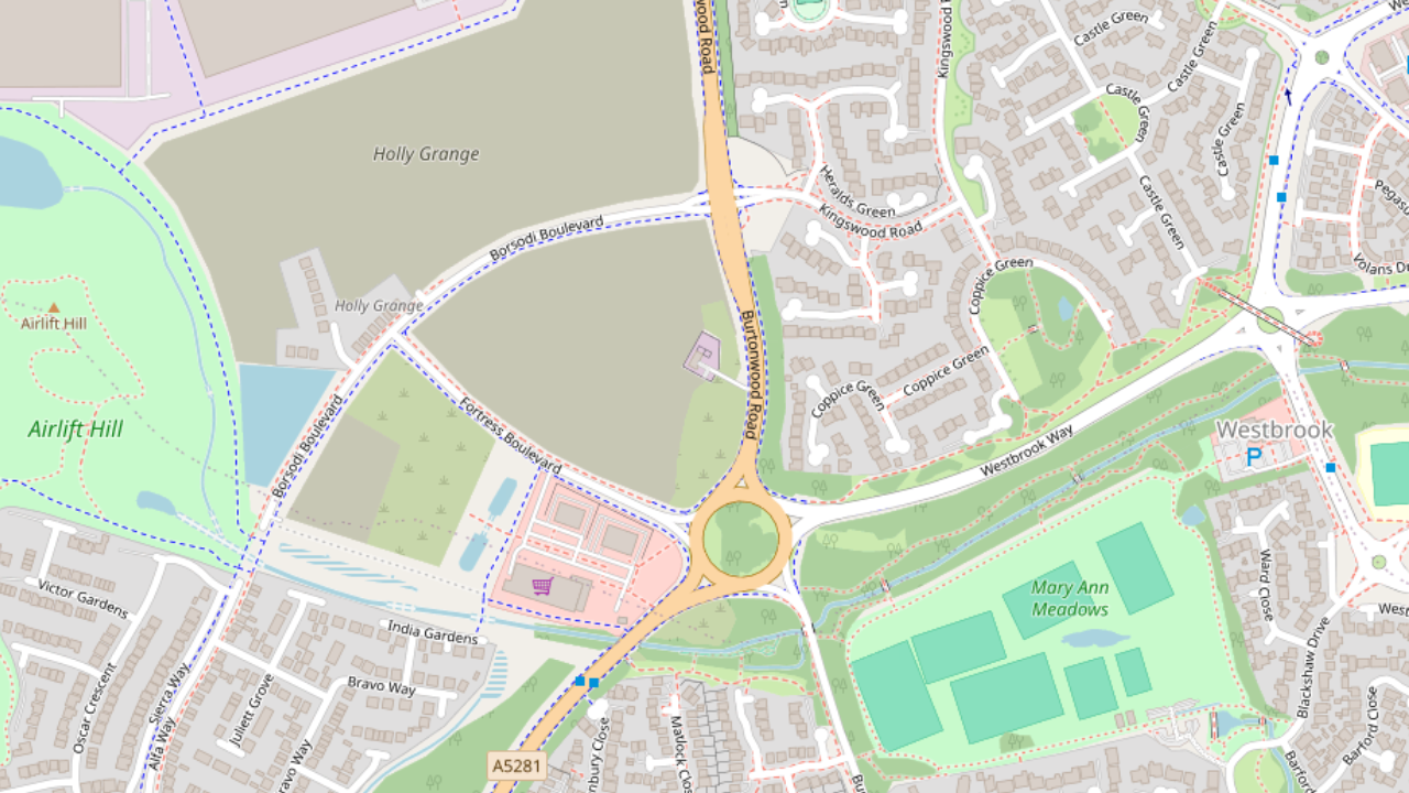
The Landings, Fortress Boulevard, Burtonwood and Westbrook, Warrington, Cheshire, WA5 3ZH
View on Bellway website
Other showhomes in this area
More about WA5 3ZH
Located on the outskirts of Warrington, WA5 3ZH offers a predominantly residential environment.
Location: This postcode encompasses areas like Longmoor Lane, situated within a well-established suburban neighbourhood. The area features a mix of modern houses and apartments, catering to families and individuals seeking a suburban lifestyle.
Industry: Limited industrial presence in the immediate vicinity.
Housing: The area is predominantly residential, with a mix of terraced houses, semi-detached houses, and apartments.
Amenities: Immediate options include local shops, takeaways, and a small shopping centre. Warrington town centre offers a wider range of supermarkets, cafes, restaurants, and leisure facilities.
Transport: Regular bus services connect to Warrington town centre and other parts of Cheshire. Access to the M6 motorway provides connections to other major cities. Warrington Bank Quay railway station offers connections to London and other destinations.
Schools: Several well-regarded schools serve the area, including Lymm High School and Appleton Grove Primary School.
Things to do:
Explore the nearby Walton Hall Gardens, a beautiful park with landscaped gardens, a lake, and a nature reserve.
Visit the Warrington Museum & Art Gallery to learn about the town’s history and culture.
Enjoy the vibrant atmosphere of Warrington town centre, with its shops, restaurants, and entertainment options.
In a nutshell: WA5 3ZH provides a peaceful suburban setting with good access to local amenities and the wider offerings of Warrington town centre. The mix of housing options, good transport links, and proximity to green spaces make it suitable for families and individuals seeking a comfortable lifestyle.
| Category | Value |
|---|---|
| Postcode | WA5 3ZH |
| Town | Warrington |
| County | Cheshire |
| Latitude | 53.4090 |
| Longitude | -2.6495 |
| Altitude | 15m |
| Nearest Train Station | Sankey for Penketh Railway Station |
| Nearest Bus Stop | Burtonwood Road (Various stops) |
| Administrative Areas | Warrington Borough Council |
| Distance from Sea | 18 miles (Irish Sea) |
| Index of Multiple Deprivation (IMD) | 5 |
| Average Household Income | £30,000 |
| Water Company | United Utilities |