in Maghull
by Persimmon Homes
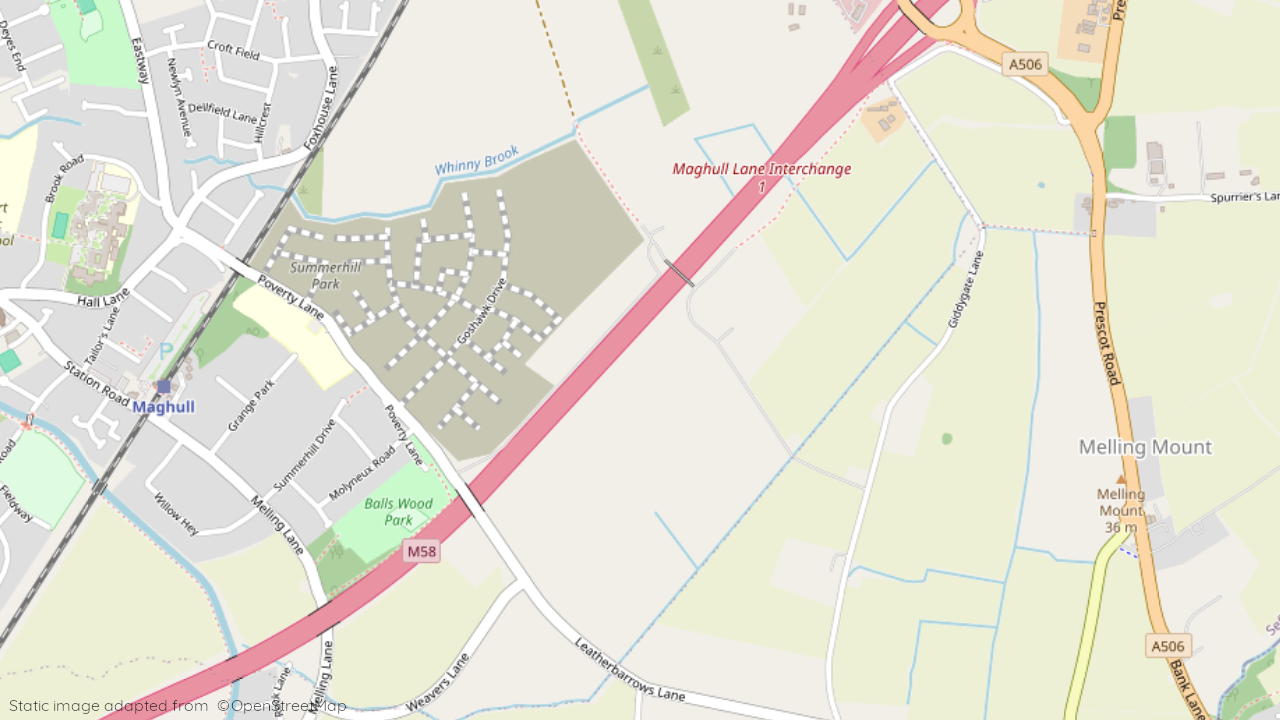
Poverty Lane, Maghull, Merseyside, L31 3DS
View on Persimmon Homes website
Other showhomes in this area
More about L31 3DS
Located in the town of Maghull, L31 3DS offers a primarily residential environment.
- Location: This postcode encompasses areas like Poverty Lane, situated within a well-established suburban neighbourhood. The area features a mix of modern houses and apartments, catering to families and individuals seeking a suburban lifestyle.
- Industry: Limited industrial presence in the immediate vicinity.
- Housing: The area is predominantly residential, with a mix of terraced houses, semi-detached houses, and apartments.
- Amenities: Immediate options include local shops and takeaways, with a wider range of supermarkets, cafes, restaurants, and leisure facilities available in Maghull town centre.
- Transport: Regular bus services connect to Maghull town centre and other parts of Merseyside. Maghull railway station provides connections to Liverpool city centre.
- Schools: Several well-regarded schools serve the area, including Summerhill Primary School and Maricourt Catholic High School.
- Things to do:
- Explore the nearby Aintree Racecourse, home to the Grand National horse race.
- Visit the Mersey Shopping Centre in nearby Bootle for a variety of shops and entertainment options.
- Enjoy the coastal attractions of the nearby seaside towns of Southport and Formby.
In a nutshell: L31 3DS provides a peaceful suburban setting with good access to local amenities and the wider offerings of Merseyside. The mix of housing options, good transport links, and proximity to both urban and coastal areas make it suitable for families and individuals seeking a balanced lifestyle.
| Category | Value |
|---|---|
| Postcode | L31 3DS |
| Town | Maghull |
| County | Merseyside |
| Latitude | 53.506752 |
| Longitude | -2.924208 |
| Altitude | 24m |
| Nearest Train Station | Maghull Railway Station |
| Nearest Bus Stop | Molyneux Road (Various stops) |
| Administrative Areas | Sefton Metropolitan Borough Council |
| Distance from Sea | 8.2 km (Irish Sea) |
| Index of Multiple Deprivation (IMD) | 19,808 (out of 32,844 areas) |
| Average Household Income | £42,000 |
| Water Company | United Utilities |